Weather and Oceanographic Forecast
MSG Forecaster is a cloud service providing high-quality, user-friendly animations and an API for weather and sea state forecasts and hindcasts.
MSG Forecaster
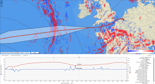
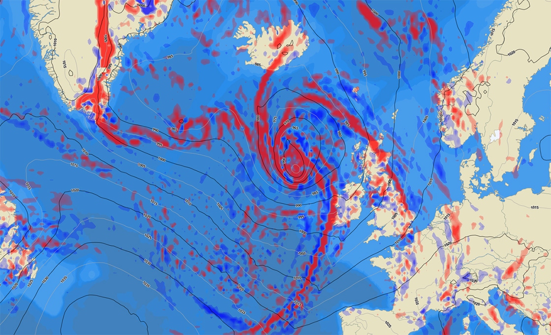
MSG Forecaster is a powerful weather and seastate cloud service that offers a high-quality user-friendly animated display and API for meteorological and oceanographic forecasting and hindcasting. The system retrieves high resolution weather and seastate data from prime data suppliers such as NOAA, ICON, GEM, MyOcean, ARPEGE and GEFS. The API supports both single position as well as multipoint position requests, along a route for example. MSG Forecaster offers 2 independent models, the Standard Model and the Premium Model.
The Standard Model
The Standard Model includes the following parameters at a grid resolution of 0.25 degrees:
- Pressure at sea level
- Temperature at sea level
- Wind strength & direction
- Accumulated precipitation
- Total cloud coverage
- Wind wave height & direction
- Swell wave height & direction
- Significant wave height
- Cyclone path prediction
- Current strength & direction
- Sea Surface Temperature
- Ice concentration
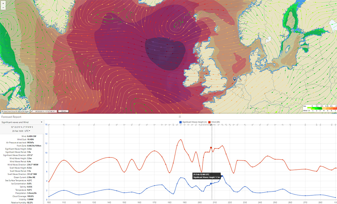
The Premium Model
The Premium Model offers the following additional parameters at a grid resolution of 0.1 degrees:
- Wind gust
- Visibility
- Frontal Zones (areas of instable weather)
- Relative humidity
- Salinity
- Plankton
- Visibility
MSG Forecaster
The data can be made available within the MSG suite of products with easy to access, animated, graphs and reports for use in passage planning, tracking, monitoring and notification. Reports can be made available on any location of your choice, the so-called “virtual weather station”. Live, up to 16 days forecast, or for analytical purposes the historic data. The T0 data as well as the historic forecast can be retrieved from our historic data base through MSG Prospector